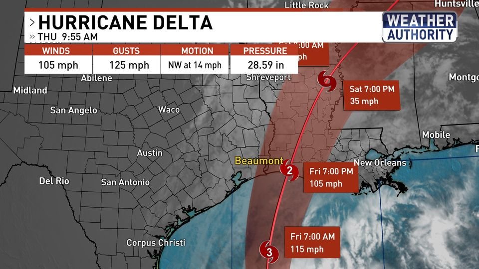
School Closures Announced Due to Hurricane Delta
The following Orange County schools have announced closures for Friday, October 9, due to impending Hurricane Delta: West Orange Cove ISD ( All after school events and extracurricular activities for Thursday and Friday have been canceled. The varsity football game against Silsbee has been rescheduled for Saturday, 10/10, at 7:30 pm.) Orangefield ISD Bridge City … Keep Reading