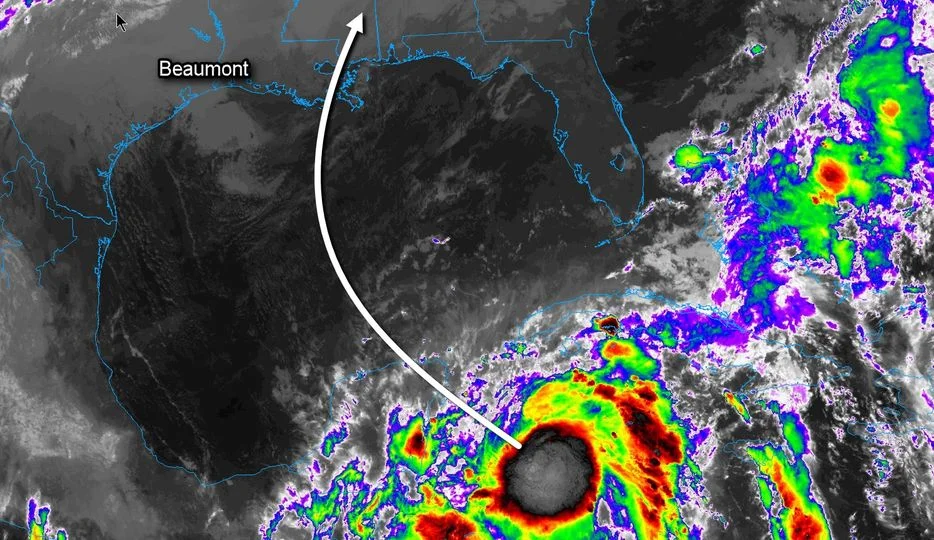
According to KFDM Meteorologist Greg Bostwick, Zeta is nearing hurricane intensity and will move across the northeastern sections of the Yucatan Peninsula tonight. By tomorrow morning, Zeta should be in the southern Gulf with a gradual turn to the north Tuesday afternoon. Conditions in the southern Gulf are favorable enough for Zeta to be a hurricane but weakening will be likely as it nears the northern Gulf coast and encounters wind shear along with cooler water temperatures.
Landfall is expected Wednesday afternoon near the mouth of the Mississippi as Zeta turns sharply to the northeast ahead of a front moving into the northwestern Gulf.
Locally, scattered showers can be expected Tuesday and Wednesday as some of the moisture of Zeta interacts with the front moving in from the northwest. Otherwise, any significant weather should stay well to our east.