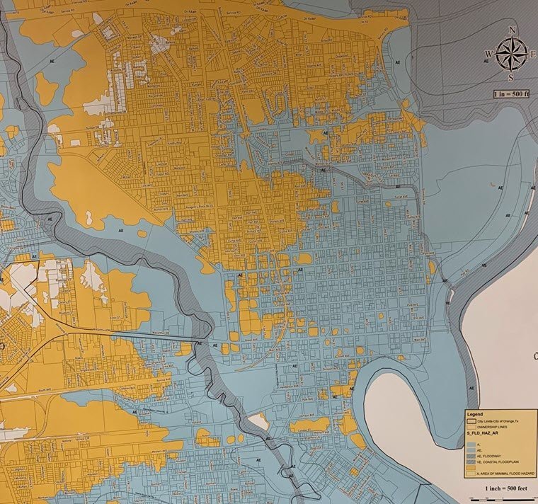
FEMA has proposed new flood risk maps, dated March 31, 2020, that could affect some citizens in the City of Orange. The 90-day appeal period began October 21, 2020, through January 19, 2021.
The Neighborhood Facility at 303 N. 8th Street in Orange has flood risk maps available for citizens to view until January 19th, 2021, Mondays – Fridays except for holidays 8 AM-5 PM with extended hours on Monday evenings; November 16th, November 30th, December 14th, December 28th, and January 11th, 5:00 PM-6:30 PM.
Comment forms are available at the Planning Department. The completed form will be forwarded to FEMA.