The City of Orange Office of Emergency Management continues to closely monitor both tropical systems that are approaching the Gulf of Mexico. The US National Weather Service Lake Charles Louisiana currently has low to medium confidence in the track and intensity of both systems.
Marco updates:
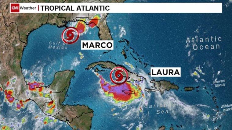
Marco continues to weaken and is not expected to cause any weather problems in our region today or tomorrow.
Laura updates:
Laura is expected to make landfall between southeast Texas and south-central Louisiana as a category 2 hurricane late Wednesday or early Thursday. Here are the expected weather impacts from Laura:
- Winds: Hurricane-force winds will be possible across the region starting late Wednesday and continuing Thursday.
- Storm Surge: At the coast, water could be over 10 feet above ground level. Depending on where Laura makes landfall, storm surge can back up rivers and bayous and flood over 30 miles inland.
- Rainfall: Depending on where the rain bands form, 5 to 10 inches with locally 15 inches will be possible starting Wednesday into Thursday.
- Tornadoes: Tornadoes will be possible in the eyewall as the hurricane approaches the coast, as well as outer rain bands.
Citizens are encouraged to continue monitoring local media sites such as weather.gov/lakecharles and official social media outlets for current information.